Several years ago we set a goal for ourselves to hike all 500 featured hikes in William L. Sullivan’s “100 Hikes…” series of guidebooks (post). In 2020 we finished the first of his five guidebooks covering the Central Oregon Cascades. The achievement became bittersweet just 10 days after finishing the final featured hike at Erma Bell Lakes (post) when a freak windstorm caused the Lionshead and Beachie fires to explode burning a number of the trails that we had hiked on our journey to complete this goal. On the one hand we were fortunate enough to see these areas before they burned but it also means being more aware of what was lost, at least for the time being. The 2020 fires were not the first to burn trails that we’d hiked in the area, sometimes after and sometimes before. Fire is part of a forest’s cycle but their time frames take much longer than ours.
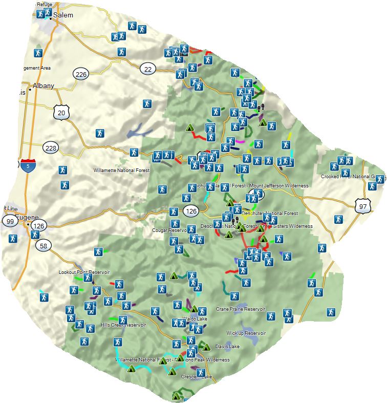
For this post we want to recap our journey to complete the 100 featured hikes while sharing a little of what the area looked like as we experienced it but first a little context. The area that Sullivan covers in the Central Cascades book, as well as his books for the other four areas, isn’t exactly easy to define. The vast majority of hikes could be fit into a rectangle starting with the upper left hand corner in Salem and extending east to Highway 97 then south to the junction of highways 97 & 58, then west until intersecting with a line due south from Salem. (The imaginary line follows I5 south until Cottage Grove where the freeway jogs SW.) That is over simplification though as that description overlaps at times with hikes described in the NW & Eastern books and excludes two featured hikes west of I5 and two east of Highway 97. The first snip below generally shows the described rectangle with the hiker symbols representing trailheads where we have started hikes (not limited to the featured hikes being discussed here). The second snip excludes any hikes that are included in one of the other areas that Sullivan covers.
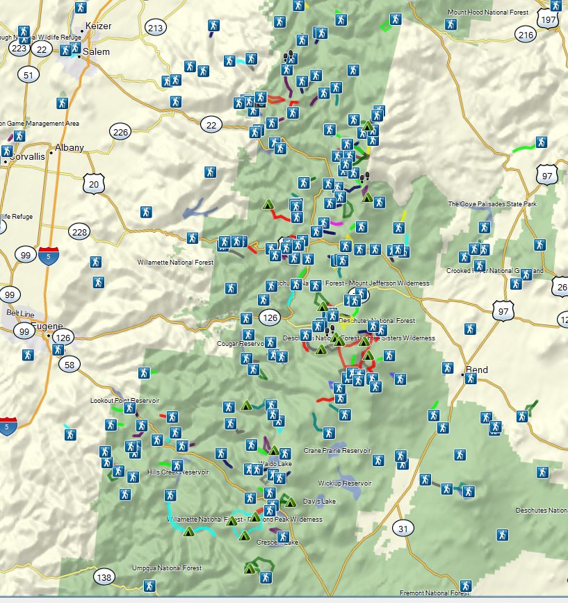
The area is home to a variety of landscapes and ecosystems and contains at least parts of nine designated Wilderness Areas: Opal Creek, Bull of the Woods, Mt. Jefferson, Mt. Washington, Three Sisters, Menagerie, Middle Santiam, Waldo Lake, and Diamond Peak.
The area has been hit by a number of large fires since 2000. The map below covers the same approximate area as the second map above. The colored areas represent fires with yellow being 2000-2005, light orange 2006-10, dark orange 2011-14, and red 15-19.
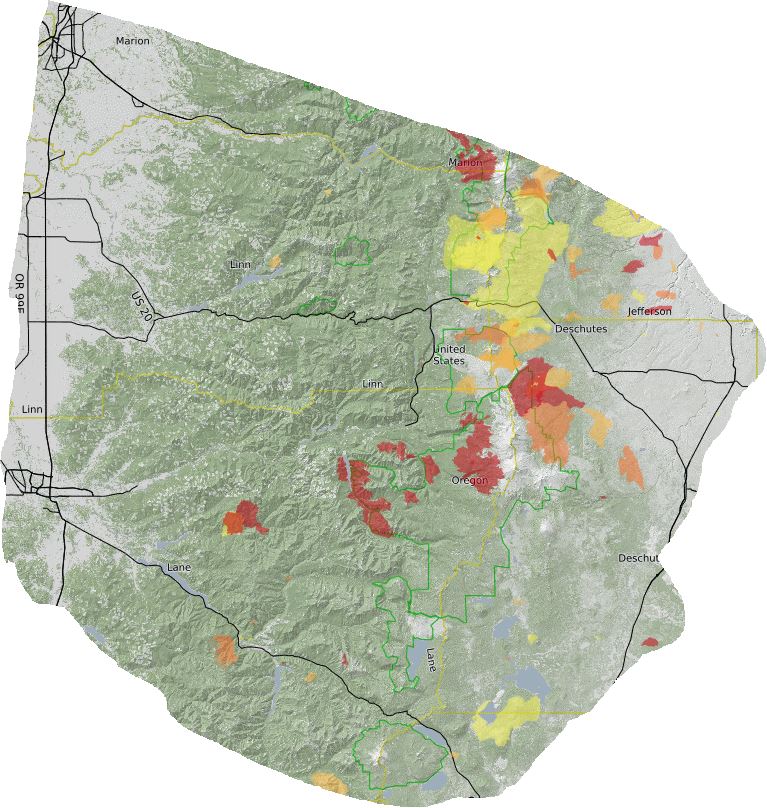
Not included in the map above are the Green Ridge, Beachie or Lionshead Fires from 2020. The Green Ridge fire did not burn over any of the featured hikes (it did burn part of the Green Ridge Trail) but the Beachie and Lionshead Fires impacted a number of hikes in the Mt. Jefferson, Bull of the Woods and Opal Creek Wilderness and surrounding areas.
The map below includes the Riverside Fire (large fire to the north), Beachie and Lionshead (center left and right which combined after Labor Day) and the Green Ridge Fire (SE).

We were lucky enough to complete many of the hikes prior to them being burned but we also hiked a number post fire and have seen the recovery in process. I’ve done my best to note below if a featured hike has experienced fire since 2000 with the year and name of the fire.
After all of that here are the 100 featured hikes from the 2012 4th edition of “100 Hikes in the Central Oregon Cascades”:
#1 – Ankeny Wildlife Refuge-Hiked 4/6/2014

#2 – Silver Fall-Hiked 2006, 7/30/2010 & 3/29/2018
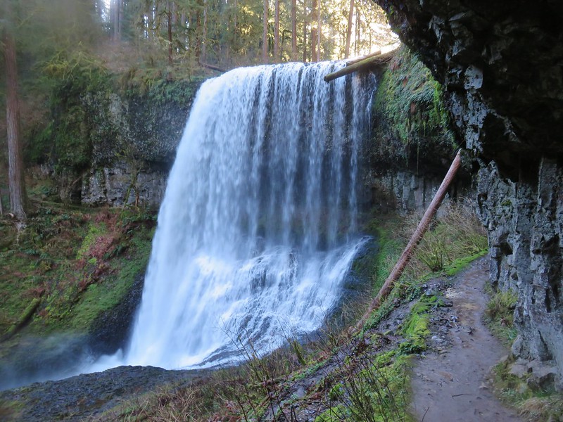 Middle North Falls
#3 – Shellburg Falls-Hiked 5/23/2011
Burned-2020 Beachie Fire
 Shellburg Falls
#4 – Little North Santiam-Hiked 4/5/2012
Burned-2020 Beachie Fire

#5 – Henline Falls & Henline Mountain 7/27/2009 & 6/14/2020
Burned-2020 Beachie Fire
 Henline Falls
#6 – Opal Creek 7/4/2010, 7/4/2012, 6/21/2014 & 7/24/2019
Burned-2020 Beachie Fire
 Jawbone Flats
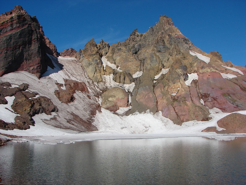
#7 – Dome Rock and Tumble Lake 7/18/2010
Burned-2020 Beachie Fire
 Tumble Lake from Dome Rock
#8 – Battle Ax and Twin Lakes 9/20/2014
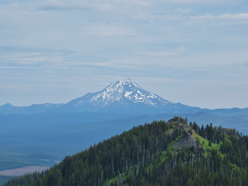
 Mt. Jefferson from Battle Ax
#9 – Stahlman Point 5/6/2013
Burned 2020 Beachie Fire
 View from Stahlman Point
#10 – Coffin Mountain Lookout 8/2/2013 & 7/4/2016

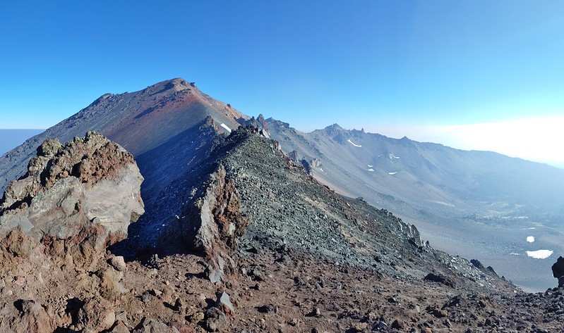
#11 – Three Pyramids 7/18/2020
 Meadow below the Three Pyramids
#12 – Crescent Mt. 7/6/2014
 Beargrass on Crescent Mountain
#13 – Browder Ridge 9/9/2012 & 7/4/2018
 Mt. Jefferson from Browder Ridge
#14 – Echo Basin and Fish Lake 6/19/2020
 Boardwalk in Echo Basin
#15 – Iron Mt. 7/25/2010 & 7/4/2014
 Iron Mountain from the trail.
#16 – House Rock 11/8/2014

#17 – Rooster Rock 6/12/2016

#18 – Cascadia State Park 6/12/2016
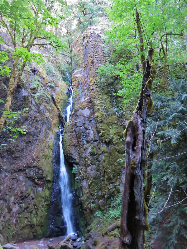 Soda Creek Falls
#19 – Crabtree Lake 9/7/2019
#20 – McDowell Creek Park 2/16/2014
 Majestic Falls
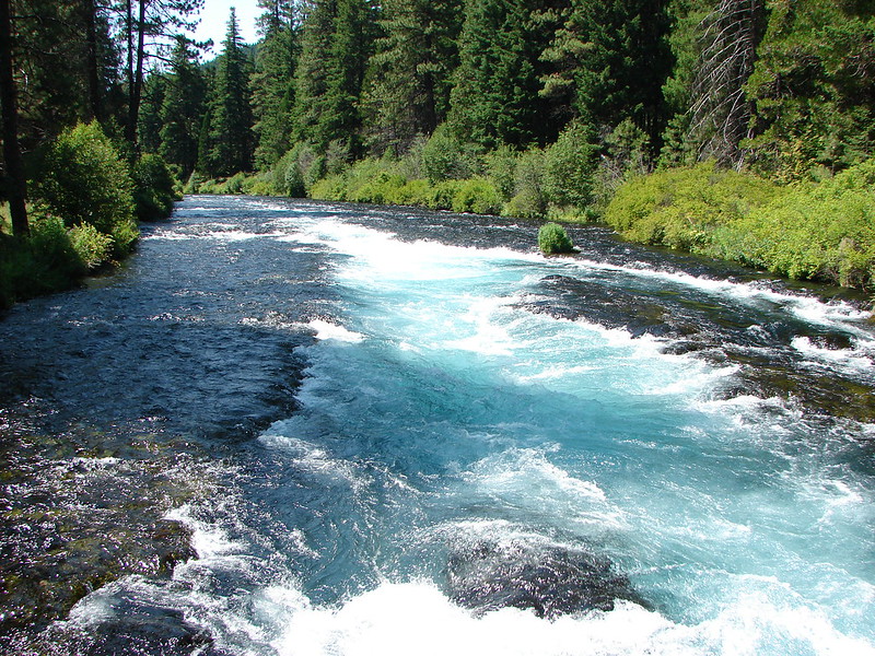
#21 – South Breitenbush Gorge 5/11/2013
Burned 2020 Lionshead Fire
 Roaring Creek
#22 – Jefferson Park 9/23/2011, 10/13/2014, & 8/8/2015
Burned partly in 2017 Whitewater and rest in 2020 Lionshead Fire
 Mt. Jefferson
#23 – Pamelia Lake 9/19/2013 & 9/8/2018
#24 – Marion Lake 10/3/2014 & 9/10/2016
Burned 2002 Mt. Marion, 2003 B&B Complex, 2006 Puzzle, 2015 208SRZ Marion
 Three Fingered Jack from Marion Lake
#25 – Duffy Lake 7/28/2010
Burned 2002 Mt. Marion, 2003 B&B Complex
 Mowich Lake and Duffy Butte from Red Butte
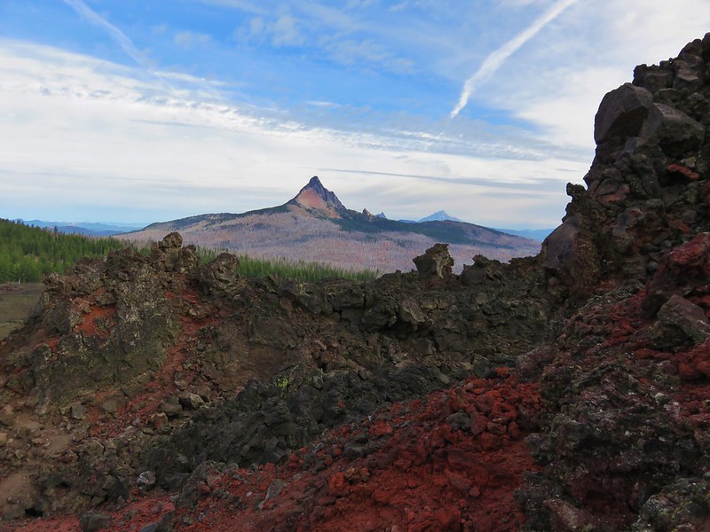
#26 – Three Fingered Jack 10/13/2012
Burned 2003 B&B Complex

#27 – Canyon Creek Meadows 7/28/2013
Burned 2003 B&B Complex
 Three Fingered Jack
#28 – Carl Lake 9/1/2018
Burned 2003, B&B Complex, 2006 Puzzle
#29 – Metolius River 7/23/2012
 Wizard Falls
#30 – Black Butte 10/13/2013 & 5/28/2018
Burned 2009 Black Butte II

#31 – Alder Springs 8/3/2011
 Deschutes River
#32 – Scout Camp Trail 5/1/2016

#33 – Steelhead Falls 5/1/2016

#34 – Smith Rock 7/14/2006, 7/13/2011 & 6/5/2015
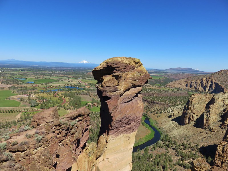 Monkey Face
#35 – Shevlin Park 8/5/2011
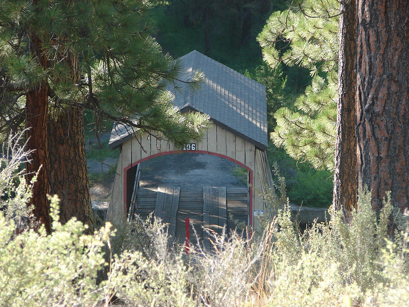 Hixson Crossing Covered Bridge
#36 – Tumalo Falls 9/27/2014

#37 – Dillon & Benham Falls 8/1/2013
 Benham Falls
#38 – Lava Cast Forest and Lava River Cave 5/28/2017

#39 – Fall River 9/16/2015
#40 – LaPine State Park 9/16/2015
 Deschutes River
#41 – Poxy Falls and Linton Lake 5/3/2014(Proxy Falls) & 7/01/2017(Linton Lake)
Burned (Linton Falls) 2017 Separation Fire
 Proxy Falls
#42 – Obsidian Trail 10/14/2012
Burned (tiny portion of trail) 2017 Separation Fire
 Obsidian Falls
#43 – Four-in-one-Cone 10/14/2012 & 8/14/2019
 View from Four-in-One-Cone
#44 – Benson Lake 10/14/2012 & 8/30/2014
Burned (small section of longer loop trail) 2010 Scott Mt. Fire

#45 – Hand Lake Shelter 8/30/2014

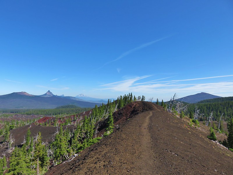
#46 – Little Belknap Crater 9/14/2015
 Mt. Washington, Three Fingered Jack, and Mt. Jefferson from Little Belknap Crater
#47 – Matthieu Lakes 7/29/2013
Burned 2017 Milli Fire
 North Sister from South Matthieu Lake
#48 – Black Crater 10/1/2016
Burned 2017 Milli Fire
 Former lookout site on Black Crater.
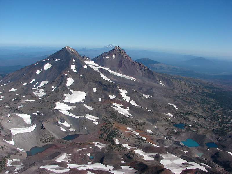
#49 – Chambers Lakes 8/26/2014
Burned 2012 Pole Creek Fire
 South Sister from Camp Lake
#50 – Park Meadow 8/27/2014
Burned 2012 Pole Creek Fire
 Middle and North Sister from Golden Lake
#51 – Tam McArthur Rim 8/31/2013
 Broken Top and Broken Hand from Tam McArthur Ridge
#52 – Tumalo Mt. 9/27/2014
 Trees near the summit of Tumalo Mountain.
#53 – Todd Lake and Broken Top 8/23/2014
 Broken Top from No Name Lake
#54 – Sparks Lake 10/1/2014
 South Sister from Sparks Lake
#55 – Green Lakes via Fall Creek 9/15/2015
 The third Green Lake
#56 – Moraine Lake and South Sister 9/1/2013
 Looking north from the South Sister.
#57 – Sisters Mirror Lake 9/19/2015
 South Sister from Sisters Mirror Lake
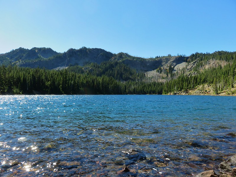
#58 – Horse Lake 8/4/2011
 Horse Lake
#59 – Doris & Cliff Lakes 9/29/2014
 Doris Lake
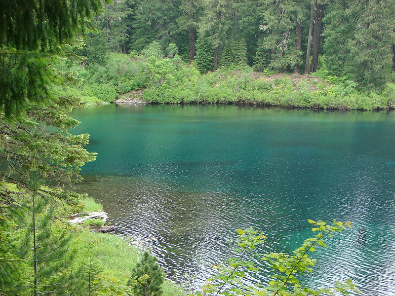
#60 – Clear Lake 6/15/2014
#61 – Sahalie & Koosah Falls 9/9/2012
 Sahalie Falls
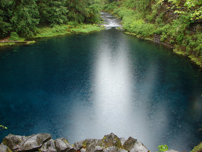
#62 – Tamolitch Pool 5/27/2013
#63 – Rainbow Falls and Separation Lake 5/3/2014
 Separation Lake
#64 – Horsepasture Mt. 7/7/2018
 South Sister and Mt. Bachelor form Horsepasture Mountain.
#65 – Olallie Mt. 9/1/2019
Burned 2017 Olallie Lookout Fire (Lookout burned down winter 2019/20).

#66 – Lowder Mt. 9/1/2019
 View from Lowder Mountain.
#67 – Tidbits Mt. 6/29/2019
 View from Tidbits Mountain.
#68 – Castle Rock 6/3/2017
 Monkeyflower and plectritis on Castle Rock.
#69 – French Pete Creek 5/16/2015
Burned 2017 Rebel and 2018 Terwilliger Fires
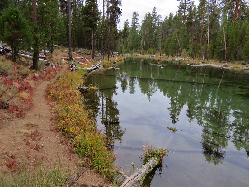
#70 – Erma Bell Lakes 8/29/2020
 Middle Erma Bell Lake
#71 – Spencer Butte 2/9/2020
 Fog over Eugene.
#72 – Mt. Pisgah 10/5/2019
 Summit marker on Mt. Pisgah.
#73 – Shotgun Creek 2/9/2020

#74 – Fall Creek 3/31/2013
Burned 2003 Clark and 2017 Jones Fires
#75 – Mt. June 6/2/2013
 Sawtooth Trail
#76 – Goodman Creek 11/10/2013

#77 – Patterson Mt. 5/5/2018
 Lone Wolf Meadow
#78 – Tire Mt. 6/8/2014
 Wildflowers along the Tire Mt. Trail.
#79 – North Fork and Buffalo Rock 5/10/2020
 Buffalo Rock from the North Fork Willamette River
#80 – Grasshopper Meadow 7/15/2017
#81 – Blair Lake and Wall Creek 6/11/2015
 Beargrass meadow along the Blair Lake Trail.
#82 – Chuckle Springs 5/24/2020
Burned 2009 Tumblebug Complex
 Indigo Springs (These springs have not burned.)
#83 – Spirt, Moon, and Pinard Falls 6/17/2020
 Moon Falls
#84 – Brice Creek 5/5/2014
 Upper Trestle Creek Falls
#85 – Bohemia Mt. 8/15/2020

#86 – Eddeeleo Lakes 8/25/2018
 Lower Eddeeleo Lake
#87 – Waldo Mt. 9/7/2013
 View from the Waldo Mountain Lookout.
#88 – Lillian Falls 8/30/2019

#89 – Fuji Mt. 10/6/2013

#90 – South Waldo Lake 8/22/2015
#91 – The Twins 9/14/2019

#92 – Rosary Lakes and Maiden Peak 9/3/2016
 Pulpit Rock from Middle Rosary Lake
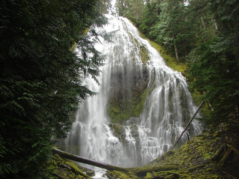
#93 – Salt Creek Falls 7/4/2013
#94 – Midnight & Yoran Lakes 10/18/2014
 Yoran Lake
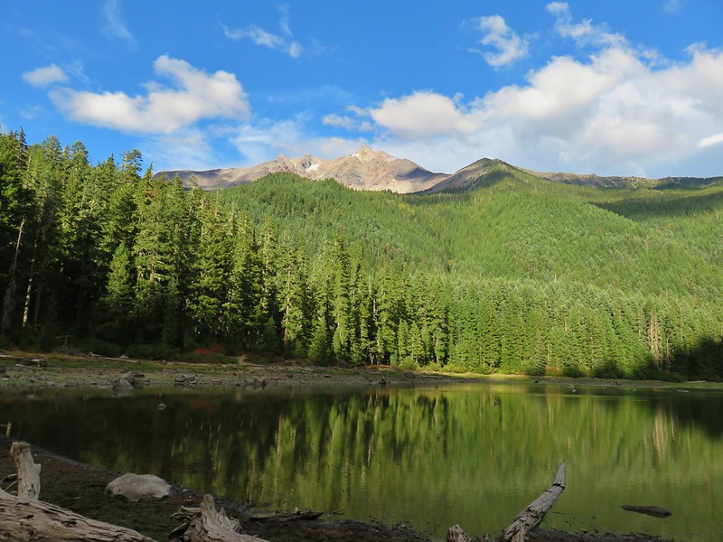
#95 – Diamond View Lake 8/22/2020
 Diamond Peak from Diamond View Lake
#96 – Fawn Lake 9/22/2018
 Huckleberry Bushes along Saddle Lake.
#97 – Divide Lake 8/24/2020
 Notch Lake
#98 – Blue and Corrigan Lakes 8/23/2020
 Diamond Peak from Corrigan Lake
#99 – Marie Lake and Diamond Peak 8/23/2020
 Diamond Peak
#100 – Timpanogas Lake 9/17/2016
 Sawtooth Mountain from Timpanogas Lake
In addition to the 100 featured hikes we’ve manged to add other hikes from Sullivan’s additional hikes located in the back of his book. In doing so we have also completed all 100 featured hikes in the 3rd edition and are just 2 hikes short of completing the 5th edition as well. There were 14 hikes from the 3rd edition that were not featured hikes in the 4th edition while the 5th edition contains 12 new featured hikes from the 4th edition (Three of these had been featured hikes in the 3rd edition.) Even with all of the hikes we’ve done, and the areas lost to fire in 2020 there are a number of trails in the Central Cascades we have yet to explore. We will continue to work those into our plans as we strive to explore as many different places as possible while we can.
Happy Trails!


15 replies on “Central Oregon Cascades”
That is fantastic! Great work!
Thanks, can’t wait to get back down to your neck of the woods someday.
I was ready to look through the whole list and pick my favorites but it quickly became clear that wasn’t gonna happen. Between the waterfalls, lush greenery, mountain views, and volcanic areas… what an amazing collection of hikes! I clearly need to do some more Oregon exploring. Now I’ll have a great list to refer to whenever I have a chance to visit.
There’s certainly plenty to choose from. Happy hiking!
You’ve taken hikebagging to new heights! Some great photos here! 🙂
Thanks. Meanwhile you keep adding to our “to-do” list down south. 😁
[…] “100 Hikes/Travel Guide Central Oregon Cascades” 4th edition last year (post) we kicked off this trip with a stop at a the Whychus Canyon Preserve, which was a new featured […]
[…] (post). Last year we completed the first of these books covering the Central Oregon Cascades (post). We followed that up by completing a pair of books in 2021 starting with Sullivan’s […]
[…] (post). In 2020 we completed the first of these books covering the Central Oregon Cascades (post). We followed that up by completing a pair of books in 2021 beginning with the 3rd edition […]
[…] 2020 we completed the Central Oregon Cascades Area (post) and followed that up in 2021 by finishing both the Oregon Coast (post) and NW Oregon (post) […]
[…] counties (post), and hiking all 100 featured hikes in William L. Sullivan’s guidebooks (Central Cascades, Coast, NW Oregon) there are still a lot of nearby trails, or at least sections of them that we […]
[…] L. Sullivan’s 4th edition of “100 Hikes/Travel Guide Central Cascades” in 2020 (post) there remain a few “loose ends” that we’d like to take care of. We have […]
[…] Southern Oregon complete, joining the Central Oregon Cascades, Coast & Coast Range, and NW Oregon & SW Washington, we are down to just 16 Eastern Oregon […]
[…] (post). In 2020 we completed the first of these books covering the Central Oregon Cascades (post). We followed that up by completing a pair of books in 2021 starting with Sullivan’s “100 […]
[…] 100/100 – “100 Hikes in the Central Oregon Cascades” 4th Edition 2012 (post) […]